


International Geodiversity Day 2026: Reading the Landscapes Behind Daily Life
SCIENCE • GEODIVERSITY
International Geodiversity Day 2026: Reading the Landscapes Behind Daily Life
The October 6 observance invites a closer look at rocks, soils, water and the evidence used to explain familiar places.
By OnelROR Editorial Team • October 3, 2026 • 28 min read
UNESCO lists International Geodiversity Day for October 6, 2026. The approaching observance offers a reason to look beyond a landscape's scenic surface and ask what its rocks, soil, water and landforms reveal. Those questions can begin on an ordinary street or in a neighborhood park, without a distant expedition or a collection of specimens.
The immediate news is the calendar date, not a newly announced discovery. The broader opportunity is educational: learning to distinguish what we can observe from what needs a map, a measurement or specialist interpretation. This guide develops that distinction through practical examples, a local observation project and a framework for evaluating public information about the ground beneath everyday life.
What the October observance actually marks
International Geodiversity Day falls on October 6 each year. UNESCO records that its General Conference approved the day on November 22, 2021. Its current calendar explicitly lists the 2026 occurrence, so readers can distinguish the forthcoming observance from the older decision establishing it. No completed October 6 event or new scientific result is being claimed here. UNESCO observance and 2026 calendar.
An international day creates a shared opening for discussion, but the date cannot do the learning by itself. A useful local response might involve a public library displaying geological maps, a school comparing landscape photographs, or a community group inviting a qualified guide to explain an accessible site. These are editorial suggestions rather than reported events. Anyone looking for an actual activity should check the organizer's current listing, including location, admission, accessibility and whether registration remains available.
The distinction matters because an observance can easily become an attractive image followed by an unfamiliar word. A stronger outcome would be a question that people can investigate after the day ends: Why does one neighborhood have exposed rock while another has thick sediment? Where does a stream obtain water between rainstorms? Why do building stones differ from one street to the next? The answers require local evidence. The questions make the day relevant without turning it into a promise that every reader will become a geologist.
Geodiversity starts with the nonliving environment
The National Park Service describes geodiversity as the variety of geological forms and processes within a geographic region. It places this nonliving foundation alongside biodiversity, rather than treating scenery merely as a backdrop. In everyday language, this means paying attention to the physical differences among places: their ground materials, shapes and processes. NPS explanation.
Consider a hypothetical walk that passes a rocky hillside, a flat river terrace and a shallow pond. A species list would describe living inhabitants. A geodiversity notebook would ask what physical conditions distinguish these locations, what evidence explains those differences and which observations remain uncertain. The two notebooks could inform each other, but they would answer different questions. A plant observed beside the pond does not, on its own, identify the underlying rock. A rock type does not supply a complete list of the organisms that will live there.
The value of the concept is therefore less about adding another label to nature and more about widening attention. A view dominated by trees may conceal differences in slope, sediment and drainage. A paved city may still contain clues in exposed stone, topography and the route of a river. A small place need not contain every possible geological feature to be worth studying. Variety can be examined at the scale of a region, a park or a short accessible route, provided the observer states the scale and avoids treating one location as a complete sample of the world.
A rock name is the beginning of an explanation
The NPS groups rocks by their formation into igneous, sedimentary and metamorphic types. It also points to composition, grain shape and the arrangement of grains as clues to rock history. These basic categories provide vocabulary, but an unfamiliar stone cannot always be identified confidently from color alone. NPS rocks overview.
For a beginner, a productive record would describe an observation before assigning a name. Is the surface visibly layered? Are individual grains apparent? Does the stone have rounded inclusions, fractures or a polished face? Is it part of an exposed outcrop, a loose object or a manufactured building component? The last question is essential: a decorative stone beside an entrance may have arrived from far away. Its presence cannot be used as evidence that the same material lies beneath the neighborhood.
Suppose two people photograph a reddish wall. One writes that the neighborhood is built on a particular sandstone. The other records that the wall contains reddish blocks and checks building records or an authoritative geological description. The second approach takes longer, yet it separates a visible material from an assertion about local geology. That discipline is more useful than confidently attaching a rock name to every photograph.
A rock identification can then lead to a better question about its origin, use or setting. The point is to build a chain of evidence. A label without explanation may be memorable, but it does little to show why the material matters in this specific place.
Processes explain why a landscape keeps changing
Weathering, erosion and deposition describe different parts of landscape change. NPS explains weathering as the breakdown or alteration of material, while erosion removes sediment. Its discussion of rivers also distinguishes areas where material is removed from areas where it accumulates. NPS weathering and erosion.
These terms become easier to use when attached to a precise observation. A photograph of loose fragments below a rock face records fragments and their position. It does not establish when each piece fell, whether a recent storm caused the change or how fast the whole cliff is retreating. Those stronger claims require additional evidence. A visitor can describe the scene accurately while leaving the explanation provisional.
An ordinary route can be revisited to practice the same distinction. Photograph a permitted public viewpoint, record the date and note recent weather as contextual information. On a later visit, compare the visible arrangement. If something has changed, document the difference rather than immediately selecting a cause. Maintenance work, seasonal vegetation, camera angle and lighting can all complicate a comparison. A useful record makes those complications visible.
This approach also protects readers from misleading dramatic images. A single photograph may show a striking landform, but it is rarely a measurement of its rate of change. Geodiversity includes processes, yet recognizing a process in principle is different from proving what happened at a particular site. The distinction allows curiosity without pretending that a brief visit provides a monitoring program.
Soil is a meeting point between materials and life
NRCS describes soil as a natural body containing mineral and organic matter, liquids and gases. Its educational explanation identifies parent material, climate, topography, organisms and time as interacting soil formation factors. It also notes that parent material may have been transported rather than weathered directly from the rock beneath it. NRCS Soil Facts.
That last detail changes an intuitive assumption. Looking at a soil surface and looking at bedrock are related activities, but they need not reveal the same story. A reader should therefore resist turning the color of garden soil into an immediate claim about the geology below the house. Purchased soil, landscaping, previous disturbance and transported material can further complicate what is visible at the surface.
A useful classroom discussion could compare two photographs with location information: one showing an exposed soil profile and another showing a ground surface. Students could ask which differences are directly visible and which require a soil description. They could list the information needed to compare the sites responsibly, such as slope position, land use and the source of the material. The exercise would teach how to ask questions rather than how to diagnose soil from a picture.
For households, the practical lesson is similar. A geological story may provide context for a garden, but a planting or drainage decision depends on actual conditions. General educational information should not replace a relevant local assessment. Understanding geodiversity means recognizing that apparently uniform ground may contain distinctions worth investigating, not assigning one universal treatment to every soil.
Water below the surface is easy to imagine incorrectly
USGS explains groundwater as water occupying saturated pores or cracks in soil and rock. Aquifers can involve different geological materials, and groundwater conditions vary. The agency also makes clear that being underground does not mean water is always readily accessible or suitable for use without treatment. USGS Groundwater Basics.
The educational challenge is that hidden water encourages overly simple mental pictures. A drawing of a large underground blue pool may be memorable, but it can lead a reader to expect the same arrangement everywhere. A conceptual sketch should state what it illustrates and what it omits. In a general explanation, the sketch should not be presented as a cross section of someone's actual property.
Imagine a community discussion about a new well. The word aquifer provides a starting point, but it does not answer questions about yield, treatment, nearby uses or the evidence behind a local interpretation. Residents can ask which measurements support the assessment, who collected them and whether the report covers the location under discussion. These are questions about documentation, not instructions for finding or installing a water supply.
A geodiversity perspective encourages people to connect surface landscapes with subsurface questions while preserving that boundary. Seeing a stream, spring or wet patch may prompt curiosity about groundwater. It does not establish a complete underground pathway. Learning which questions cannot be resolved by looking is as important as learning which features can be observed.
The physical setting helps frame biodiversity questions
NPS describes the nonliving landscape as an important foundation for biodiversity and species distribution. Its explanation supports considering physical variety in conservation discussions. It does not imply that geology alone determines every ecological outcome. NPS nature's stage.
An applied way to use the idea is to compare the questions asked about two nearby sites. A biological survey might record which species occur. A physical description might record slope, exposed materials, water setting and landscape position. Bringing the descriptions together could suggest questions for a qualified ecologist or geoscientist. It should not turn a casual association into a proven cause.
For example, a hypothetical group notices different vegetation on an upper slope and beside a stream. The group can describe that contrast, then ask what additional information would help explain it. Shade, disturbance and land management may matter alongside ground conditions. A sound account would keep multiple possibilities open until evidence narrows them. This is a better exercise than declaring that one visible rock explains the entire plant community.
The practical benefit is a more complete vocabulary for discussing a landscape. If conservation is described only through charismatic animals or plants, less visible physical features may be overlooked. If it is described only through geological features, living relationships may be overlooked in the opposite direction. Geodiversity invites a wider set of questions while leaving room for the expertise needed to answer them.
Geological heritage involves choices about value
The USGS Geoheritage Sites of the Nation project provides a public route into places where geological significance intersects with societal value. An inventory can help people identify sites for further study, but a featured site is not automatically an unrestricted destination. Readers still need the responsible manager's access information. USGS geoheritage project.
There is a useful distinction between physical variety and a decision that a particular feature deserves special recognition. An ordinary roadside exposure might help explain local geology without being an internationally significant site. Conversely, an important geological feature may be visually modest. The visitor's impression and the scientific evaluation need not coincide.
When reading an inventory entry, ask why the place is included. Does the explanation emphasize an unusual record, a teaching opportunity, a connection to community history or another documented value? An article that merely calls a site spectacular leaves the reason unclear. An informative description explains the evidence and the value while identifying the authority behind the interpretation.
This distinction can improve local proposals too. A group advocating for interpretation of a familiar landscape should explain what people could learn, who has evaluated the feature and what protection or access arrangements are appropriate. Recognition is most useful when it comes with intelligible reasons. The goal is not to rank every neighborhood against a famous geological landmark, but to understand what a specific place contributes to knowledge and community life.
A geopark is more than an attractive geological destination
UNESCO defines Global Geoparks as unified geographical areas where internationally significant geological sites and landscapes are managed through protection, education and sustainable development. Its explanation emphasizes community participation and a formal management approach. The designation is reviewed through a recurring revalidation process. UNESCO Global Geoparks.
For a reader planning to learn about a geopark, the key question is not simply whether the place photographs well. Look for its explanation of geological significance, current educational offerings and the organization responsible for management. A trustworthy destination page should make it possible to distinguish an official designation from a loosely used tourism description.
Before sharing a recommendation, verify the actual site listing and then consult the local manager. The designation does not answer practical questions about opening hours, transport, accessible routes or current closures. Those details belong to the operating organization and may change. A careful article can explain the concept without inventing a local schedule.
Community participation also changes how the place should be described. Residents are not background characters in a visitor's geological story. A respectful account can identify whose interpretation is being presented, where local history is documented and which information is available in the community's own voice. This is an editorial standard for good description, not a claim that every destination already meets it. The framework helps readers judge whether geological interest is being connected to actual stewardship and public learning.
Maps are evidence with a purpose and a scale
The National Geologic Map Database's help material explains scale as a relationship between distance on a map and distance on the ground. The database helps users discover geological mapping, but a map's suitability depends on what was mapped and how detailed the product is. USGS map database help.
Start by reading the map title, legend, date and accompanying explanation. A colorful patch is not self explanatory. The legend supplies the meaning of the color or symbol; the text may describe limitations, mapping methods or the intended regional context. A screenshot stripped of those elements may look authoritative while losing the information needed to understand it.
Consider a hypothetical regional map used in a neighborhood meeting. It might be helpful for orienting the discussion, but zooming far into the image does not create new measurements. Enlarging a symbol makes it bigger, not more precise. Participants should ask whether a more suitable local product exists and whether the question requires an assessment beyond published mapping.
This reading habit is valuable even outside geology. A map always selects information for a purpose. A geological map, a property boundary map and a visitor trail map can cover the same area while answering different questions. Using the right product starts with naming the question. The most visually detailed map on a screen may still be the wrong evidence for the decision being discussed.
Topography and ground material are different layers of a place
USGS educational resources treat topographic mapping as a way of representing the shape and features of the land surface. Geological information concerns another set of characteristics. Together, these resources help readers separate a landscape's form from the materials and history being interpreted. USGS topographic mapping.
In an introductory exercise, use a map legend to identify how elevation or relief is represented, then compare that information with a separate geological description. Ask what each source contributes. The exercise should remain about interpretation of published information, not about determining whether an unassessed route or site is safe.
For example, a hypothetical ridge can be identified as a raised landform in a surface representation without that representation identifying every rock beneath it. A geological description may explain mapped material without supplying current trail conditions. The two pieces of information fit together, but neither substitutes for the other.
This is especially relevant to digital displays that combine several layers. Switching a layer on or off can make it seem as if every visible boundary has the same meaning. A good reader checks the legend for each layer and notes who supplied it. If two boundaries do not match, that may reflect different subjects, scales or methods rather than an error. Before drawing a conclusion, determine what the lines are intended to represent. Separating layers is one of the simplest ways to improve landscape literacy.
A soil survey can inform questions without settling every site issue
NRCS describes soil surveys as systematic examinations, descriptions, classifications and maps. It makes current survey information available through Web Soil Survey. The public material can help users understand documented soil characteristics and interpretations for an area. NRCS soil survey explanation.
For a general reader, the first task is to identify the survey's coverage and read its definitions. Technical terms should be interpreted through the accompanying documentation, rather than through assumptions based on ordinary language. A report about an area is useful context; a specific current site may still require direct investigation for the question at hand.
Imagine someone trying to understand why a public garden's educational panel mentions soil texture. The survey can provide vocabulary and a starting point for asking the garden's staff about their actual observations. It should not be treated as proof that every individual bed has an identical condition. Previous disturbance, imported materials and management history may need consideration.
A responsible community discussion can therefore use the survey to organize questions: What property is being described? What units are used? What is the interpretation intended to support? What further assessment is needed? This keeps public information useful while avoiding a common mistake: assuming that access to a digital database removes the need for judgment. Geodiversity literacy includes knowing how to read an institutional resource and how to describe its limits.
City streets offer a different kind of geological observation
A neighborhood walk need not pretend that the city is an untouched natural exposure. It can instead investigate the relationship between visible materials and the built environment. Publicly accessible walls, paving and monuments may offer an opportunity to compare texture and appearance, subject to access rules and without touching or damaging surfaces.
The important editorial boundary is provenance. A polished building stone may be genuine stone while being unrelated to local bedrock. To tell its story, seek a plaque, building archive, manager's explanation or a documented material specification. If no source is available, describe the visible feature and leave the origin unidentified. That is still a useful observation.
A hypothetical library project could assemble photographs of three civic buildings and invite participants to record what they notice. The next stage would separate observations from questions: which differences are visible, which names are supported by documentation and which claims remain unverified? A photograph of a carved stone detail could lead to an investigation of craftsmanship as well as geological material. The project would connect subjects without inventing a historical supply chain.
This approach is particularly useful for people who cannot travel to a major natural site. It broadens participation while acknowledging that built materials have been selected, transported and worked. The city becomes a place to practice asking informed questions, rather than an excuse to label every facade as a local geological specimen.
Landscapes can be read through several kinds of records
A geological interpretation, a historical map and a community account can contribute different information about the same place. Combining them requires care about what each record actually establishes. A historical map may show how a place was represented at a particular time. An oral account may document a person's experience or inherited knowledge. Neither should be silently converted into a measurement it does not contain.
An editorial project might begin with a familiar hill or river crossing. The researchers could assemble a current official description, a dated historical map and a documented local account. Each item should retain its source and context. Where accounts differ, the article should explain the difference rather than forcing a single confident story.
For instance, a remembered name for a rock feature could help explain community identity while leaving its geological classification to a qualified source. Conversely, a technical description of the rock may say little about the place's social meaning. Bringing the records together enriches the explanation precisely because the sources are doing different work.
The resulting article should tell readers which statements come from which record. That transparency allows someone else to follow the evidence and identify questions that remain open. A place can be culturally meaningful without every associated story being a scientific claim, and scientifically interesting without its cultural history being fully documented. Recognizing those distinctions is a form of respect for both kinds of knowledge.
Start a local project with one answerable question
The following project is an editorial suggestion for the October observance, not a reported UNESCO program. Choose one publicly accessible feature and one question narrow enough to investigate. A question about why a particular official map uses a certain symbol is more manageable than a question about the complete geological history of an entire region.
Write down the question before collecting images. Then identify the institution most likely to provide relevant information: a geological survey, a park manager, a museum or an educational resource linked to the site. Record the source title and date so that the explanation remains traceable. If the source does not answer the question, say so rather than stretching a nearby fact into an answer.
Keep three columns in the notebook: observation, explanation and uncertainty. An observation might be that a public sign describes a rock layer. The explanation should cite the sign or a more detailed official resource. The uncertainty column might note that the sign does not provide an age estimate or an account of how the interpretation was made. This separation prevents accidental embellishment.
At the end, produce a short account with a photograph or sketch, a source link and a clear unresolved question. Success is not measured by the number of technical words used. It is measured by whether another reader can understand what was seen, how the explanation was supported and what still requires further investigation.
Build an observation route around access and evidence
A local learning route should be planned around actual access information. Select places with permission to visit and a route appropriate to participants. Check the responsible site's current advice before going. Avoid treating an attractive photograph or an old article as evidence that a location is open, accessible or suitable today.
An example route might include a museum display, an established public overlook and a civic building with documented stonework. This is a hypothetical combination, not a recommendation of a specific destination. Each stop would answer a different question: how material is described, how a landform is interpreted and how people use geological materials.
Give each stop an evidence card. Include the location, source of interpretation, observation prompt and one limitation. For a museum specimen, the limitation might be that it is displayed away from its original setting. For a viewpoint, it might be that distance prevents examination of small features. For a building, it might be that only a documented component has an identified source.
An accessible alternative can use institutional photographs and maps indoors. The learning objective should remain the same even when physical access differs. A person examining a carefully sourced image can still practice separating description from inference. Designing the activity around that objective makes participation more flexible and reduces pressure to reach a difficult location merely to make the project feel authentic.
Photographs need captions that preserve uncertainty
A good geological caption tells the reader what the image shows, where the information came from and what the image cannot establish. The location should be as specific as appropriate for a public, permitted site, but sensitive locations should follow the manager's guidance. Avoid publishing precise directions to vulnerable features simply because a camera recorded them.
In a hypothetical example, a caption might say that the photograph shows visible layers from an established overlook, with the interpretation linked to the site's official educational page. If the photographer has no reliable identification, the caption should describe the layers without assigning a formation name. Honest uncertainty improves the image's educational value.
Scale and context also matter. A close photograph can exaggerate the apparent size of a feature, while a wide view may hide the details under discussion. Where appropriate, include a safe contextual view or explain the framing. Do not place objects on fragile surfaces simply to create a scale reference. A caption can acknowledge that a measurement was not taken.
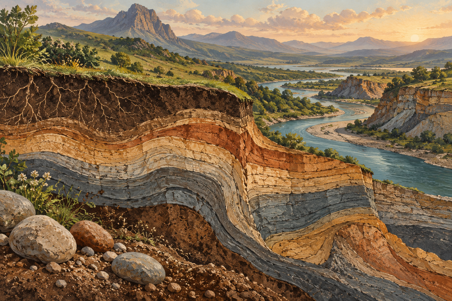
For this article, the featured artwork is an original editorial illustration of an imaginary landscape. It is not a photograph of a named site and should not be used to infer an actual geological sequence. Identifying illustration clearly is part of the same practice: readers should be able to distinguish explanatory artwork from evidence gathered in the field.
Good questions make a guided visit more useful
A guide's expertise becomes easier to understand when visitors ask about the evidence behind an explanation. Instead of demanding a technical name for every surface, ask which features support the interpretation and where a beginner can read more. A qualified answer may include uncertainty, competing interpretations or a distinction between a general process and a local observation.
Useful questions include: What can be established from this viewpoint? Which details require measurements or laboratory work? Has the official interpretation changed, and where is that change documented? What should visitors avoid disturbing? These prompts are suggested questions, not statements that any particular site has an unresolved controversy.
For a mixed group, ask the guide to define a term before building further explanations upon it. If a map is used, request a brief account of its legend and scale. If an age is mentioned, ask whether it refers to the material, the landform or a later event affecting it. A single place can contain several time related questions, so clarity about the object being dated helps prevent confusion.
After the visit, compare notes and distinguish what the guide said from what participants inferred. Attach a public source where possible. Do not turn a remembered explanation into an exact quotation unless it was accurately recorded and appropriate to publish. The aim is a reliable account that remains understandable after the excitement of the visit has faded.
Conservation includes leaving evidence in context
NPS asks visitors to leave natural rocks and minerals where they are found so that others can experience them. At a managed site, follow the applicable rules about collecting, access and disturbance. A personal interest in geology is not permission to remove, scratch or rearrange material. NPS visitor guidance.
For an educational group, the organizer should clarify those boundaries before the activity begins. A photograph, description or sketch can document a feature without creating a collection. If a legitimate classroom exercise requires specimens, use materials obtained through an authorized educational source and explain their provenance. Do not assume that a small object is insignificant because it fits in a pocket.
Context is central to interpretation. An object separated from its setting may lose information relevant to understanding its origin or relationship to nearby features. Even when a visitor cannot judge the scientific significance, leaving the object undisturbed allows the responsible manager or researcher to assess it. A possible discovery should be reported through the site's stated process, without independent excavation.
This is also a communication issue. A social media post should not encourage others to copy a collecting activity where the rules are unknown. The better public example is a documented observation that names the source and respects access limits. Curiosity and conservation can support each other when learning does not depend on taking part of the place home.
Evaluate a geodiversity story before sharing it
Before circulating an article, identify its central claim. Is it reporting a newly announced finding, explaining an established concept, promoting an event or describing a destination? These genres can coexist, but the reader should not have to guess which claim is current. A calendar observance should not be dressed as a scientific breakthrough.
Then examine the evidence. A primary institutional page may support a program's date or definition. A research paper may support a specific finding within its methods and scope. A tourism page may describe visitor services. Each source has an appropriate role. The strongest looking source is not automatically relevant to every sentence in a story.
Check dates carefully. A recently retrieved page can contain an older explanation. A new page can describe an earlier event. Neither circumstance is inherently misleading, but an article should make the timeline clear. In this guide, the upcoming 2026 observance provides the current hook, while several background resources explain established concepts.
Finally, look for unsupported precision. A location, age, rate or number can make prose sound authoritative while being disconnected from evidence. If a claim is not supported, remove it or qualify it. A useful story should leave the reader with better questions and reliable routes to further information. It should not require the reader to trust confident wording in place of a traceable source.
A library or classroom can make the topic concrete
An indoor activity can be built around three carefully sourced items: a geological map, an institutional landscape photograph and a documented specimen or material image. Ask participants to identify what each item contributes. The map offers a spatial representation, the photograph records a view and the specimen shows an object. None provides every part of the explanation.
The organizer can prepare short prompts at different levels. Beginners might compare visible texture and shape. More advanced learners might read the legend, trace a source reference or identify a missing measurement. The same materials can support several levels of participation without requiring anyone to invent an answer.
A second stage can focus on captions. Give participants a deliberately incomplete caption and ask what information is missing. Does it identify the source? Is the place named? Is a photograph being confused with an illustration? Does the wording claim more than the image shows? Revising a caption is a small task with a clear result, making the abstract idea of evidence easier to practice.
Finish by assembling a shared glossary limited to the terms actually used. Each definition should point to an authoritative resource and, where helpful, a specific example from the activity. A modest glossary understood by the group is more useful than a long list of unexplained technical vocabulary. The October date can open the activity; the completed materials can remain useful throughout the year.
Keep the scale of conclusions matched to the scale of work
A short local project can improve observation skills without producing a complete scientific assessment. Its conclusions should be proportional to what was done. If participants examined three photographs and a map, say that. If they visited a permitted viewpoint, describe the conditions and sources used. Do not imply systematic field research merely because the notes are organized.
This matters when a learning exercise enters a public discussion. A school display about local geology can inform interest, but it should not be presented as a technical judgment on a construction plan, water supply or conservation boundary. Those decisions require relevant assessments and accountable expertise. The educational work can help people ask clearer questions of those assessments.
An effective final product may therefore include an explicit boundary: the project documents visible features and published interpretations, while certain questions remain unresolved. That sentence strengthens the work by telling readers how to use it. It also creates a route for future learning, such as consulting a geological survey or attending a managed educational event.
The most transferable skill is calibration. Describe the evidence at hand, distinguish explanation from speculation and stop where the evidence stops. Those habits remain useful whether the subject is a rock wall, a soil map or a regional landscape. They turn an unfamiliar scientific term into a practical way of paying attention.
What a useful October 6 outcome could look like
By the end of a geodiversity activity, participants should be able to name a physical feature, explain which source supports their description and identify one question requiring further evidence. That is a concrete outcome. It is more meaningful than memorizing a slogan or collecting a large set of photographs without context.
A community could retain a small public resource list, an accessible route description verified by its manager or a classroom display that distinguishes observation from interpretation. These are possible outcomes rather than reports of existing initiatives. Their value would depend on accuracy, maintenance and whether people can actually use them.
For an individual reader, the next step can be modest. Find an official educational resource about a familiar place. Read the accompanying map explanation or site description. Compare it with what is visible from a permitted location. Record what the source explains and what it leaves open. There is no need to force every observation into a complete account on the first attempt.
International Geodiversity Day 2026 brings that invitation onto the calendar for October 6. The landscape itself will not become simpler on that date. The opportunity is to become more careful in reading it: attentive to physical variety, aware of the limits of a quick view and willing to follow evidence into a deeper explanation of the places that support daily life.